GeoMine AI — Geospatial Intelligence from Orbit to Decision
GeoMine AI turns multi-source satellite imagery — optical, radar and hyperspectral — into decision-ready intelligence for mining exploration, agriculture and urban development. Remote, fast and cost-efficient: no field visits required to get your first answers.
Traction on the Ground
Built in Saudi Arabia for the region. GeoMine AI is already delivering pilots and capability-building programmes across mining, cement and agriculture.
Cement-sector pilot area analysed for raw-material exploration
Palm estate mapped with hyperspectral imagery
Remote-sensing training programmes delivered
Core sectors: mining, agriculture, urban development
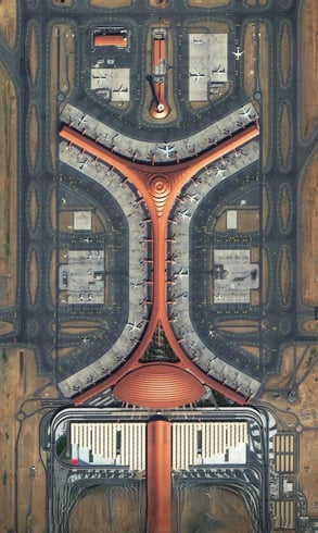
Mining & Exploration — Find More, Drill Less
Exploration is the most expensive and uncertain phase of any mining project. GeoMine AI de-risks it remotely.
What GeoMine AI delivers:
- Mineral and alteration mapping from multispectral and hyperspectral imagery.
- Lineament and structural analysis to prioritise targets.
- Raw-material assessment and quarry/site management for cement and aggregates.
- Change detection and environmental monitoring across licence areas.
Result: faster target generation and fewer unnecessary field campaigns — reducing exploration cost and time-to-decision.

Agriculture & Palm Health
From large date-palm estates to new reclamation projects, GeoMine AI gives owners a precise, field-by-field view.
Key capabilities:
- Palm counting, density and planted-area mapping.
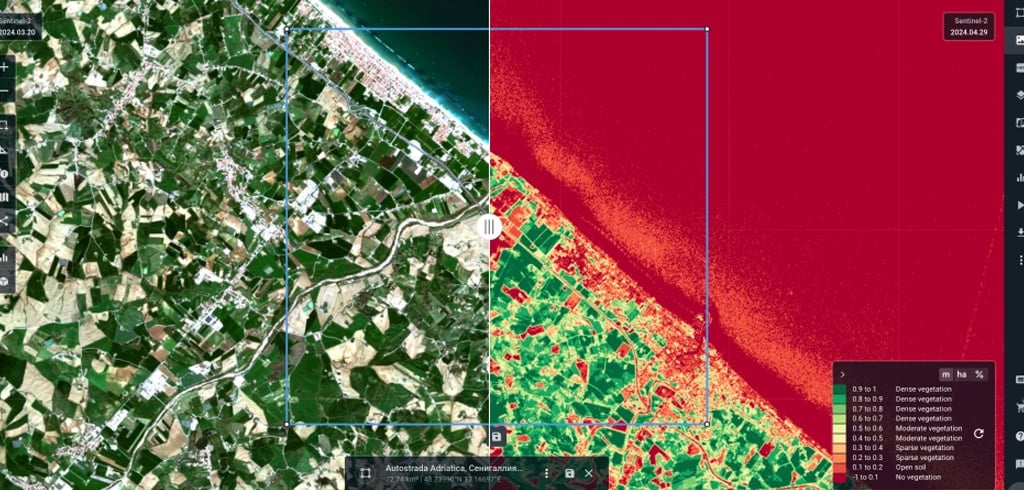
- Vegetation health indices (NDVI, GNDVI, SAVI) and early stress detection.
- Water-stress and irrigation-efficiency analysis.
- Land-preparation and expansion planning for new farms.
In Siwa Oasis, our analysis showed that only ~20% of a 772-feddan estate was actually planted — giving the owner a precise baseline for expansion and irrigation planning.
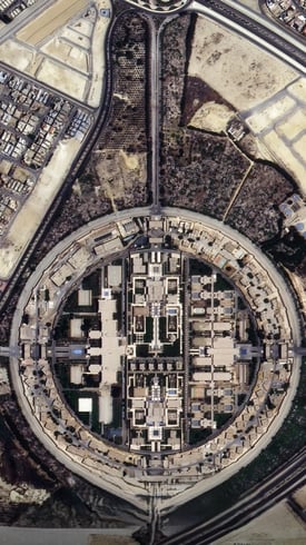
Urban Development & Infrastructure
Mega-projects move fast. GeoMine AI keeps owners and regulators on top of every square kilometre.
Use cases:
- Construction progress monitoring and change detection.
- Land-use and land-cover mapping for master planning.
- Infrastructure and pipeline corridor monitoring.
- Encroachment and illegal activity detection.
How It Works
A simple four-step pipeline from orbit to decision:
The GeoMine AI workflow:
- Acquire: multi-source commercial imagery — optical, SAR and hyperspectral — tasked or from archive.
- Process: calibration, correction and fusion with your existing GIS and field data.
- Analyse: AI/ML models for classification, anomaly and change detection.
- Deliver: clear reports, maps and dashboards your team can act on.
Why GeoMine AI
Built by a Saudi-licensed Earth Observation company with 30+ years of technology leadership behind it.
What sets us apart:
- Remote-first: actionable answers without field mobilisation.
- Multi-sensor: optical, radar and hyperspectral in one workflow.
- Local: Saudi entity with local data processing options.
- Ecosystem: Microsoft partner and member of the ESRI Startup Program.

Start with a Pilot
We prove value on your own site before you scale.
How engagement works:
- Sample assessment: a first look at your area of interest.
- Scoped pilot: a defined area, clear KPIs and agreed deliverables.
- Scale: recurring monitoring and analytics as an annual subscription.
Data Sovereignty & Security
Your geospatial data is a strategic asset. We treat it that way.
Our commitments:
- Local processing and storage options in Saudi Arabia.
- Built around national data-governance and cybersecurity requirements.
- Role-based access and full client ownership of results.
- Responsible-AI principles: explainability and human oversight.
Who It's For
- Mining and exploration companies
- Cement and building-materials producers
- Agricultural investors and large farm operators
- Giga-project developers and urban planners
- Government entities and research institutions
 From Pixels to Decisions
Every satellite image holds answers — where to explore, which fields need water, how a project is progressing.
GeoMine AI exists to surface those answers quickly, accurately and securely, so leaders in mining, agriculture and urban development can act with confidence.
Ready to See Your Site from Space?
Tell us about your area of interest and we will propose a focused pilot.