Know Where to Drill, Plant and Build — Before You Mobilise a Team
GeoMine AI turns optical, radar and hyperspectral satellite data into decision-ready reports for mining, agriculture, groundwater and infrastructure. Your first answers arrive remotely, in weeks, with your data kept in Saudi Arabia.
Results Our Clients Act On
Built in Saudi Arabia for the region's hardest terrain.
Cement raw-material area screened from orbit
Date-palm estate mapped with hyperspectral imagery
Sensor types fused in one workflow: optical, SAR, hyperspectral, thermal
Field visits needed for the first assessment
Field-First Decisions Are the Most Expensive Ones
Every exploration campaign, borehole and site survey commits people, equipment and months before you know if the location is right. Across the Kingdom's vast, remote terrain, that uncertainty is your largest hidden cost.
GeoMine AI reverses the order. We screen the whole area from orbit first, rank the best targets, and send your teams only where the evidence points. See what a pilot delivers →
One Platform, Four Decisions
Mining & Exploration — Find More, Drill Less
- Mineral and alteration mapping from multispectral and hyperspectral data.
- Lineament and structural analysis to rank targets.
- Raw-material assessment for cement and aggregates.
Outcome: fewer field campaigns, faster target generation.

Agriculture & Palm Health — See Every Field, Every Week
- Palm counting, planted-area and density mapping.
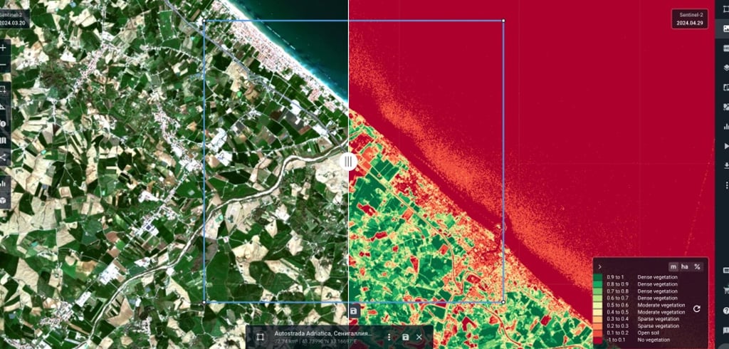
- Crop-stress detection (NDVI, GNDVI, SAVI) before yield is lost.
- Irrigation-efficiency and water-stress analysis.
Proof: in Siwa, we showed only ~20% of a 772-feddan estate was planted. Agriculture solutions →

Groundwater — Find Water Beneath the Desert
- Groundwater-potential zone maps, ranked high, moderate and low.
- Buried palaeo-channels revealed by radar.
- Priority sites for geophysics and test drilling.
Outcome: fewer dry boreholes. Groundwater exploration →
Urban & Infrastructure — Every Square Kilometre, Every Month
- Construction-progress and change detection.
- Land-use mapping for master planning.
- Pipeline and corridor monitoring, encroachment alerts.
Outcome: issues found before they reach the critical path. Urban solutions →

Built in Saudi Arabia, for the Region's Hardest Terrain
- Remote-first: answers without field mobilisation.
- Multi-sensor: optical, radar and hyperspectral in one workflow.
- Local: Saudi entity with in-Kingdom processing and storage options.
- Ecosystem: part of the Horizon IT group, a Microsoft partner, and a member of the Esri Startup Program.
- Leadership: 30+ years of technology delivery across the Middle East and Africa.

From Orbit to Decision in Four Steps
- Define — You share your area of interest and the decision you need to make.
- Acquire — We source archive or newly tasked optical, SAR and hyperspectral imagery.
- Analyse — AI models classify, detect anomalies and rank targets, fused with your GIS and field data.
- Deliver — You receive maps, a technical report and a prioritised action list your team can execute.
Your Geospatial Data Stays Yours — and Stays in the Kingdom
- Processing and storage options inside Saudi Arabia.
- Designed around national data-governance and cybersecurity requirements.
- Role-based access; full client ownership of every output.
- Explainable AI with expert review on every deliverable.
Questions Procurement and Technical Teams Ask
How accurate is satellite analysis compared with field surveys?
GeoMine AI does not replace ground truth; it decides where ground truth is worth collecting. Every pilot is validated against your existing samples, wells or field records, and accuracy is reported as a pilot KPI.
How long does a pilot take?
Most pilots run 4–8 weeks from data acquisition to final report, depending on area size and whether new imagery must be tasked.
What do we need to provide?
The area boundary (KML, shapefile or coordinates) and the decision you need to make. Existing GIS, field or drilling data improves results but is optional.
Where is our data processed and stored?
In-Kingdom processing and storage options are available, and all outputs belong to you.
Can results integrate with our GIS?
Yes. Deliverables come in standard GIS formats alongside PDF reports and dashboards.
How is the service priced?
The pilot is a fixed-scope engagement; recurring monitoring is an annual subscription sized by area and update frequency.
Request a Pilot Assessment
Prove It on Your Own Site First
Tell us your area and your question. Within 5 business days we return a scoped pilot proposal: area, deliverables, KPIs and timeline.
- Sample assessment
- Scoped pilot with agreed KPIs
- Annual monitoring subscription
Your information is used only to prepare your proposal. See our Privacy Policy.
Ready to See Your Site from Space?
A 30-minute call is enough to scope your first pilot.